


Israel adopting apartheid Bantustan model for Palestinians
The Israeli government calls them Areas A, B, and C of “Judea and Samaria.” To the rest of the world, the areas are known as Palestine, a nation that has state observer status in the United Nations and is a full member of the UN Educational, Scientific, and Cultural Organization (UNESCO) and the Arab League.
No other country in the world recognizes the existence of “Judea and Samaria” but 142 nations recognize the independence and statehood of Palestine.
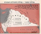
Area C of the West Bank of Palestine is under full Israeli political and military control and there are plans underway to annex Area C to Israel. The Israeli military has security control over Area B, largely Palestinian rural land and in danger of being gobbled up by Israeli annexation if the expansionist Israel Home Party, Yisrael Beiteinu, and the right-wing of Likud have their way. Area A is under the control of the Palestinian Authority and includes its administrative headquarters city of Ramallah and other Palestinian population centers.
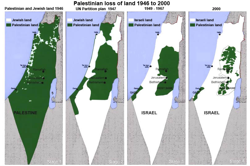
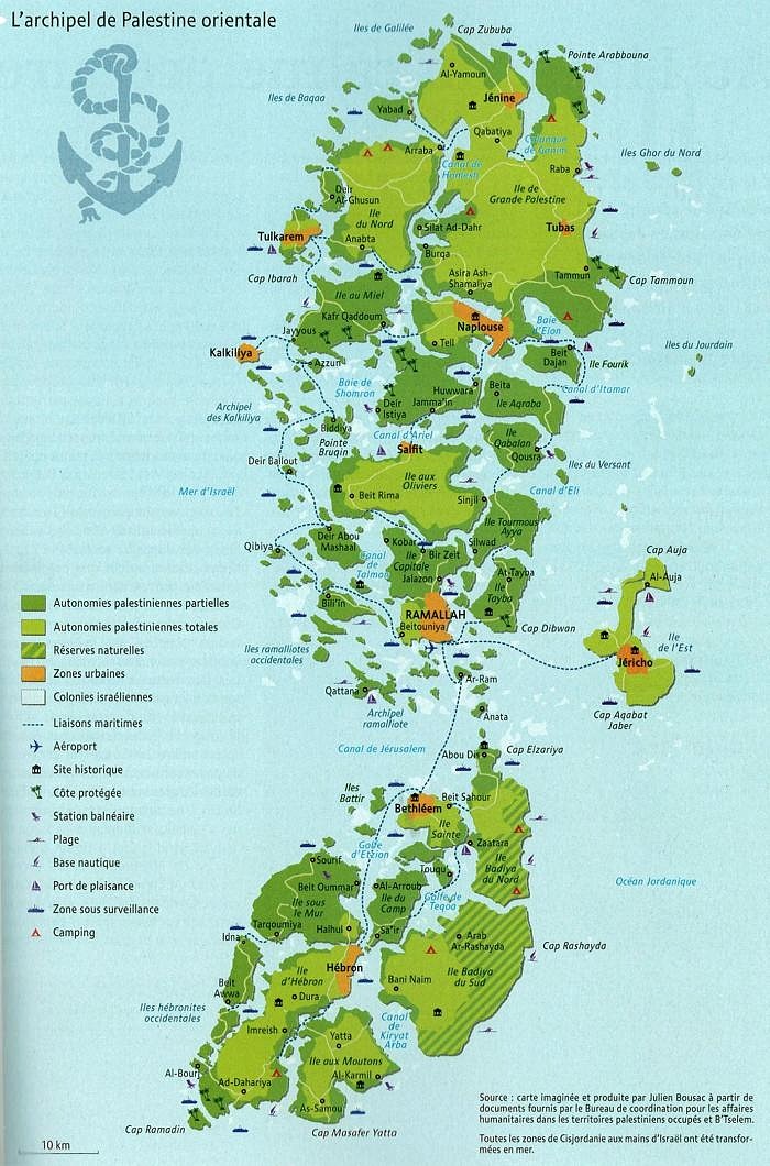
When one looks at a map of the Israeli area boundaries in the West Bank one can only be reminded of the patchwork quilt of majority African “Bantustans” created by apartheid South Africa.

